In November I was contacted by Richard Kuenneke, Media Producer of Oakview Road Media, Carbondale, Illinois and the writer-director of an award winning documentary about the Mound City National Cemetery about my work on the Mound City 1862 layout. Richard has done research on Mound City, Cairo and the Ironclads built there and is also a member of the cemetery’s Preservation Commission. He provided some much needed detail information to assist with the layout.
The most enlightening new information is a detailed map of the Mound City Naval Depot with the buildings identified. The number of structures and layout of the vessels lead me to believe that this map was drawn very late in the war if not upon conclusion. The depot was operated for a few years after the war even though all the heavy ironclads had been scrapped or sold by 1868. The map also refers to the hospital as the “Army Hospital” and not the “Naval Hospital”, this may help date the map if the transition date can be found.
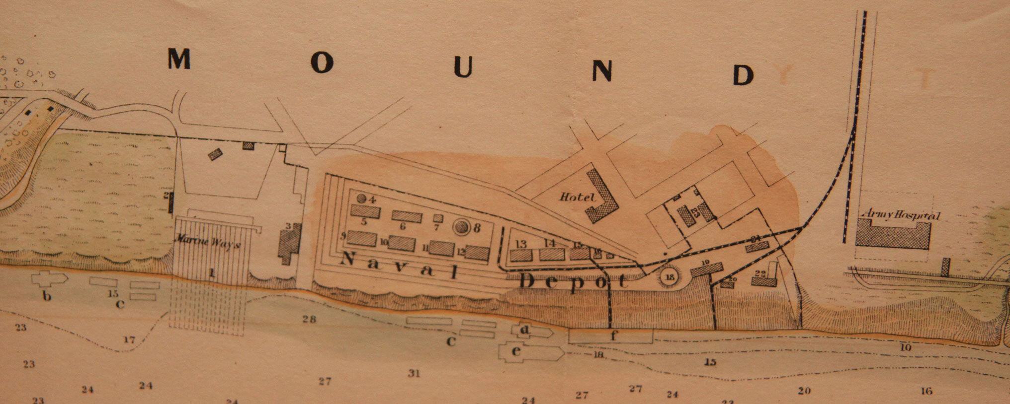
Mound City Map Legend
1. Marine Ways
2. Blacksmith Shop
3. Saw Mill
4. Paint Shop
5. Blacksmith Shop
6. Timber House
7. Guard House
8. Mustering Office
9. Machine Shop
10. Machine Shop
11. Carpenter Shop
12. Carpenter Shop
13. Machine Shop
14. Store House
15. Store House
16. Executive Office
18. Mound
19. Ordnance Office
20. Battery
21. Offices
22. Gun Carriage Store
23. Marine Barracks
a) Coal Barges
b) Mechanics Float
c) Floating Carpenter and Blacksmith Shops
d) Naval Inspection Boat
e) Flag Ship
f) Wharf Boat
g) Powder Barges
h) Gun Boat
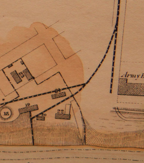
The new information of course means that some of my original assumptions on my track plan are incorrect. The original maps I had, only indicated about where the line went and did not show any building details. From written accounts I had been able to ascertain that there was munitions, cannons and all manner of things to build and outfit anything from a transport to a heavy ironclad. This means a few warehouses administrative buildings, forge, lumber and so on. We also know that a small detachment guarded the depot and would have a few cannon or a battery.
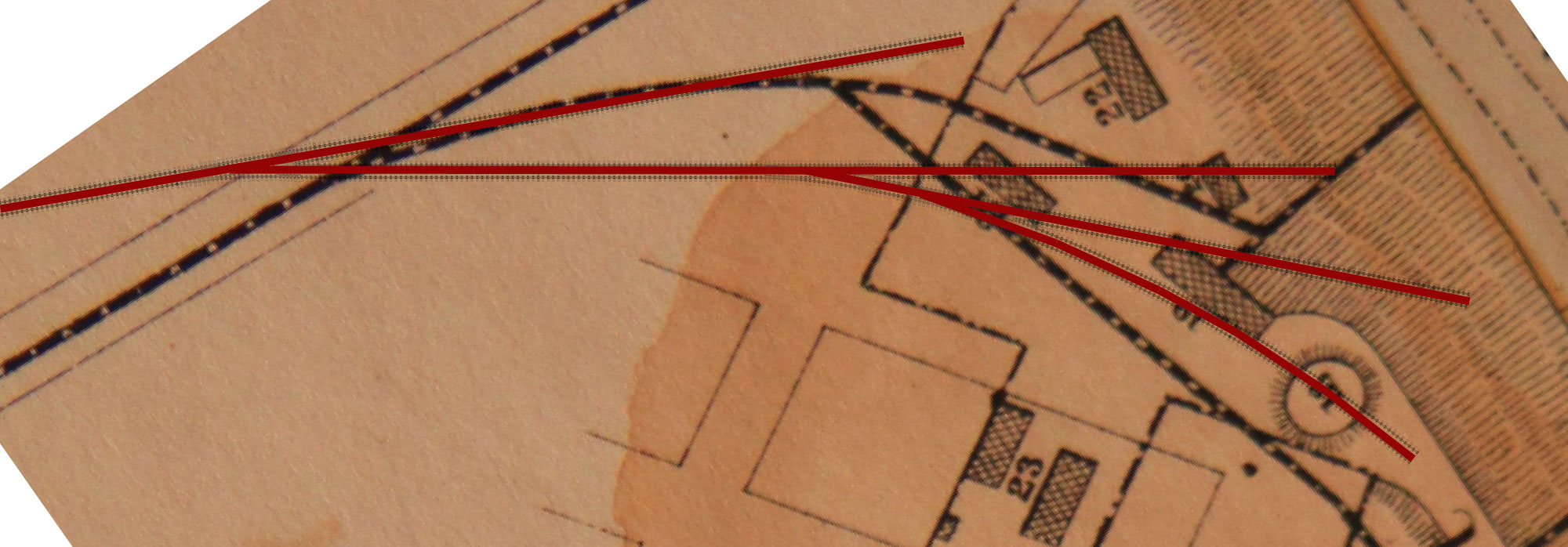
This new information confirms many of my assumptions were correct and the track plan is very close to reality. I will use the new information for placement of the buildings. The one error in my track plan is I have an extra track within the depot area. I added the track to create a 5-3-3 inglenook for more operating options. Other differences include track angles and spur lengths. As in any modeling situation, compromises must be made to make the scene fit the available space. Even with the differences, I think the affect will look correct with the current track plan.
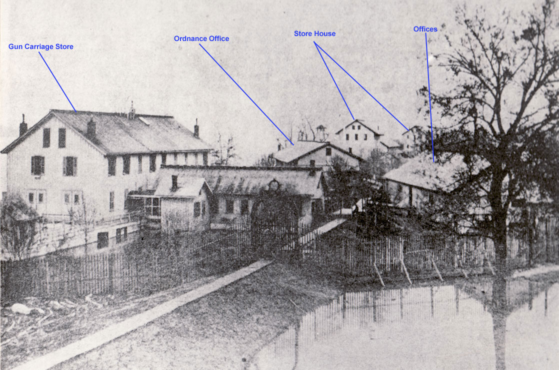
Another new piece of information is a photo taken from atop the hospital looking at the buildings within the Naval Depot. This image most likely was taken several years after the end of the war. A pathway can clearly be seen with a large iron gate to enter the depot. The path is raised just like a railroad roadbed. When compared to the map, the building on the left has the “L” shape of the #22, the gun Carriage Store. From this we can deduce that this is much later, the tracks have been removed and replaced with the walkway. One item to notice is the water next the fence and the Gun Carriage Store. I do not believe this water is normal. The only year the city was inundated (and these buildings were standing) was the spring of 1867 when a new levee broke.
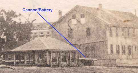
The new map helped to identify the buildings in the other images I had collected so far and see a few things I had overlooked. The map shows in the area I am modeling a battery (#20). A cannon can be seen poking out from behind the structure without walls. The map shows a square structure as the battery so I am wondering, is this a covered battery? Is the structure to protect powder/munitions?

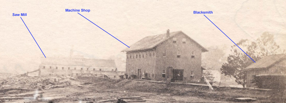
I had always wondered what the large structure at the end near the marine ways was. The profile reminded me of a lumber complex from northern Michigan I had researched. As the map shows, that is exactly what it is. The map also makes me think this photo is from an earlier period than the map. The map indicates there should be two machine shops in close proximity. There is only one here with plenty of room around it.
The next task will be to create mock-ups and test fit the structures for appearance and to create depth within the scene.
I want to thank Richard for providing this much needed information!
You must have been beyond words when all that new info surfaced … I had a few of those “aha-moments” when doing research … and I know how exhilarating they can be!